

 Livres anciens
 Images
 Fonds Jean Bernabé
 Fonds René Maran
 Esclaves de Guyane
 Esclavage en Martinique
 Catalogue collectif des périodiques
 Audio-Vidéo
 Études et recherches
 Etudes Caribéennes
 Tramil
 Or
Or Esclavage et résistances
14 documents satisfont la requête. Vérifiez les termes recherchés ou relancez la recherche sur le texte intégral
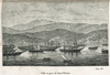
 | Ville et port de Saint-Thomas | Partager |

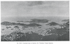
| | Vue de Charlotte-Amalia, Capitale de Saint-Thomas Auteur(s) : Lenatur Année de publication : | Partager |
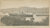
 | Voyages en Guinée et dans les Iles Caraïbes en Amérique : tirés de sa correspondance avec ses amis, traduit de l'allemand, avec figures Auteur(s) : Isert, Paul Erdmann (1756-1789) Année de publication : | Partager |