


Filtrer par

1189 résultats
Exporter les résultats sélectionnés
Sélectionner tous les résultats de la page
-
Notice détaillée
Titre :
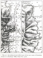
Fig. 21 — An embayed and cliffed part of the east coast of Dominica (from U. S. Hydrogr. Office Chart No. 1318).
Extrait de :
The Lesser Antilles
Type :
Image - Carte, plan
Description :
Une partie de la côte Est de l'île de la Dominique
Conditions d'utilisation :
Domaine public

-
Notice détaillée
Titre :
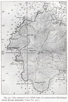
Fig. 25 — The embayed and cliffed coast of southwestern Martinique (from British Admiralty Chart No. 371).
Extrait de :
The Lesser Antilles
Type :
Image - Carte, plan
Description :
Dessin topographique des sendiments et des falaises cotières du Sud Ouest de la Martinique
Conditions d'utilisation :
Domaine public
-
Notice détaillée
Titre :
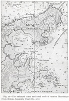
Fig. 26 — The embayed coast and coral reefs of eastern Martinique (from British Admiralty Chart No. 371).
Extrait de :
The Lesser Antilles
Type :
Image - Carte, plan
Description :
Carte topographique des sendiments côtiers et des récifs coralliens de l'Est de la Martinique
Conditions d'utilisation :
Domaine public
-
Notice détaillée
Titre :
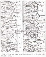
Fig. 32 — The east coast of St. Lucia (from U. S. Hydrogr. Office Chart No. 1261).
Extrait de :
The Lesser Antilles
Type :
Image - Carte, plan
Description :
Carte topographique de la côte Est de Sainte Lucie
Conditions d'utilisation :
Domaine public
-
Notice détaillée
Titre :
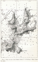
Fig. 4 — Part of one of the Saints (from U. S. Hydrogr. Office Chart No. 362).
Extrait de :
The Lesser Antilles
Type :
Image - Carte, plan
Description :
Carte d'une partie des îles des Saintes
Conditions d'utilisation :
Domaine public

-
Notice détaillée
Titre :
Fig. 41 — The eastern end of St. Thomas and the western end of St. John (from U. S. Coast and Geodetic Survey Chart No. 905).
Extrait de :
The Lesser Antilles
Type :
Image - Carte, plan
Description :
Carte de la grande extrémité de Saint Thomas et l'extrême Ouest de Saint John
Conditions d'utilisation :
Domaine public

-
Notice détaillée
Titre :
Fig. 43 — Norman and Peter islands (reproduced from British Admiralty Chart No. 2019). These skeleton islands lie southeast of St. Thomas, two miles back from the outer border of the great Virgin Island bank. The form of the islands suggests a long period of erosion without abrasion followed by a brief period of relatively strong submergence in association with which the headland cliffs were abraded.
Extrait de :
The Lesser Antilles
Type :
Image - Carte, plan
Description :
Carte topographique des 'îles Norman et Peter
Conditions d'utilisation :
Domaine public
-
Notice détaillée
Titre :
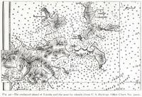
Fig. 44 — The embayed island of Tortola and the near-by islands (from U. S. Hydrogr. Office Chart No. 3904).
Extrait de :
The Lesser Antilles
Type :
Image - Carte, plan
Description :
Carte topographique des sendiments de l'île de Tortola
Conditions d'utilisation :
Domaine public
-
Notice détaillée
Titre :
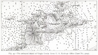
Fig. 45 — The embayed island of Virgin Gorda (from U. S. Hydrogr. Office Chart No. 3904).
Extrait de :
The Lesser Antilles
Type :
Image - Carte, plan
Description :
Carte topographique des sendiments de l'île de Virgin Gorda
Conditions d'utilisation :
Domaine public
-
Notice détaillée
Titre :
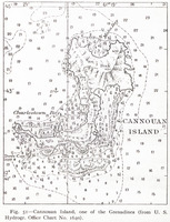
Fig. 51 — Cannouan Island, one of the Grenadines (from U. S. Hydrogr. Office Chart No. 1640).
Extrait de :
The Lesser Antilles
Type :
Image - Carte, plan
Description :
Carte topographique de l'île Cannouan des Grenadines
Conditions d'utilisation :
Domaine public
