Livres anciens
 Images
 Fonds Jean Bernabé
 Fonds René Maran
 Esclaves de Guyane
 Esclavage en Martinique
 Catalogue collectif des périodiques
 Audio-Vidéo
 Études et recherches
 Etudes Caribéennes
 Tramil
 Or
Or Esclavage et résistances
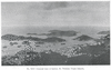
 | Métissage et réélaborations iconographiques ou la construction de nouvelles identités Auteur(s) : Bertin-Elisabeth, Cécile | Partager |
 | Métissage et réélaborations iconographiques ou la construction de nouvelles identités Auteur(s) : Bertin-Elisabeth, Cécile Année de publication : | Partager |
 | La Caraïbe dans l'économie mondiale de l'époque mercantile à nos jours Auteur(s) : Geoffroy, Edouard Guengant, Jean-Pierre Année de publication : | Partager |

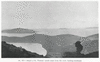
 | Ville et port de Saint-Thomas | Partager |
| | Métissage et réélaborations iconographiques ou la construction de nouvelles identités Auteur(s) : Bertin-Elisabeth, Cécile | Partager |
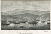
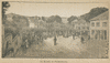
| | Le Marché de Frédéricksted Auteur(s) : Lenatur Année de publication : | Partager |
| | Charles Sainte-Claire Deville Auteur(s) : Bocourt Tourfaut Année de publication : | Partager |

| | Le Port de Christiansted Auteur(s) : Jeunesse, Auguste (18..-18..) Année de publication : | Partager |